Introduction
You know what's funny? I've been teaching geography for over a decade now, and the one topic that gets students most excited is rivers and drainage systems. Not because it's thrilling on the surface—literally water flowing downhill—but because once you understand it, you realize how our entire civilization, economy, and culture are shaped by where water decides to flow.
Let me be honest with you: when I first studied this topic as a student myself, I thought it was just memorizing river names and their tributaries. Boring, right? But then my geography teacher—this absolutely brilliant woman named Ms. Sharma—showed us how the Ganges shaped an entire empire, how the Monsoons determine our harvest cycles, and how understanding drainage patterns can literally predict where cities will develop. That's when it clicked for me.
Today, I want to share that same perspective with you. Because in SSC CGL and UPSC exams, when they ask about rivers, they're not just testing whether you know the Godavari is in south India. They're testing whether you understand the fundamental geography of our nation—its climate, its people, its economy, and its future.
Understanding Drainage Systems: The Foundation
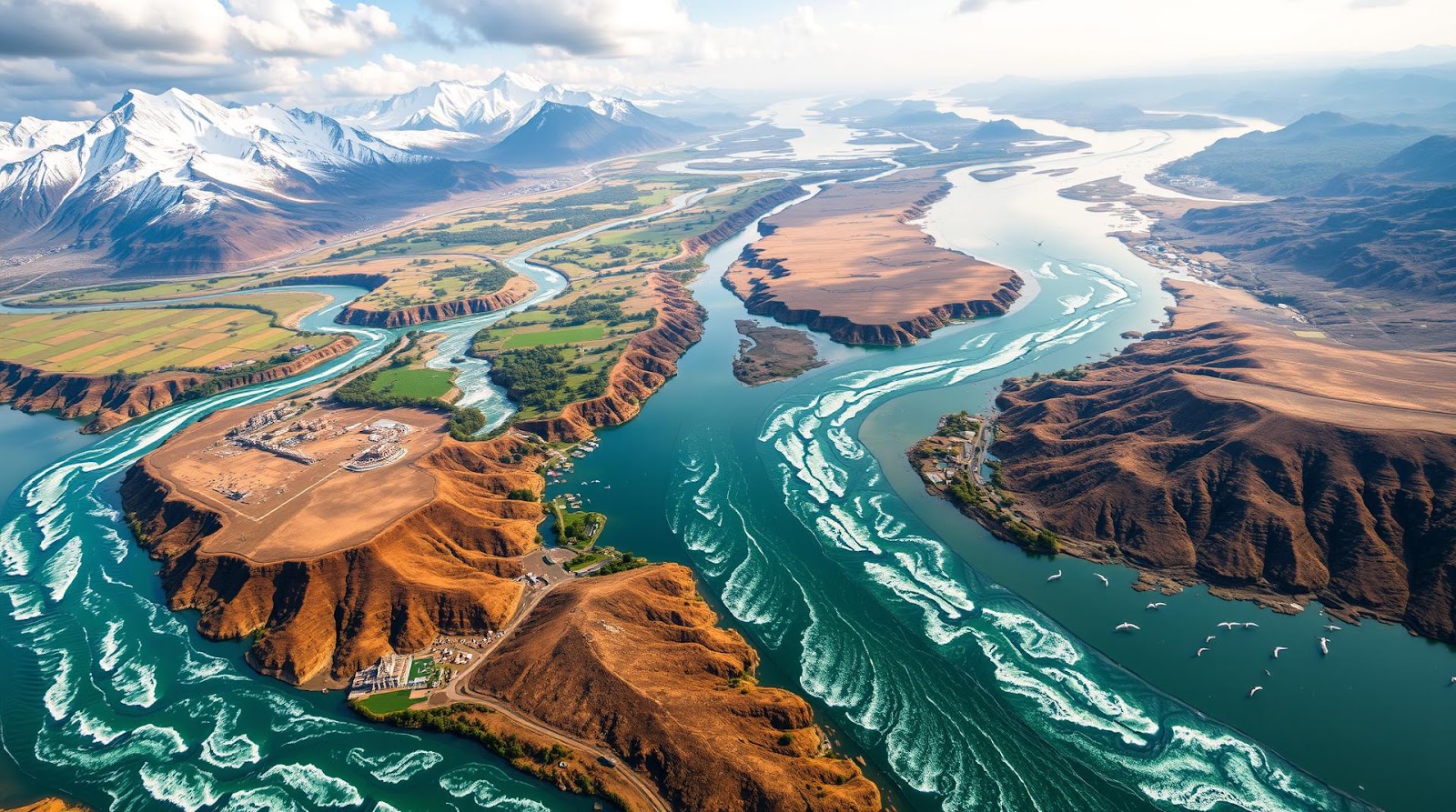
Before we dive into specific rivers, let's talk about what drainage actually means. Think of it this way: if your house roof collects rainwater, where does it flow? Downhill, right? Through gutters and pipes into the ground or storm drains. India's entire landmass works exactly like that—water from higher elevations flows toward lower elevations, creating a network of streams, rivers, and eventually reaching the sea.
Now here's the interesting part: India has three major drainage systems, and understanding them is the key to understanding 80% of river-related questions you'll encounter.
The Three Major Drainage Basins
1. The Himalayan (or Indus-Ganges-Brahmaputra) Drainage System: This is the big daddy of Indian rivers. It covers the Indo-Gangetic plain and is primarily fed by the Himalayas. These are perennial rivers—meaning they flow year-round because the Himalayas have glaciers and snowfall. The Indus, Ganges, and Brahmaputra all originate here. I tell my students to remember: "HIM-ALAYA starts it all" (both the mountain and the major rivers!).
2. The Peninsular (or Deccan) Drainage System: South of the Vindhyas, we have rivers like the Godavari, Krishna, Cauvery, and Narmada. These are predominantly seasonal rivers, dependent on the monsoons. Why? Because the Deccan plateau isn't glaciated. When the monsoons fail, these rivers dry up. Many exams ask why southern rivers are different from northern ones—this is your answer.
3. The Coastal Drainage System: Smaller rivers that flow directly into the sea from the Western Ghats and Eastern Ghats. Think of the Periyar, Tapti (which is actually a peninsular river), and many others. These are often overlooked, but they're crucial for understanding how water drains in coastal regions.
One Memory Trick That Actually Works
Let me give you a trick I tell all my students. For remembering the major rivers and their key characteristics, use this phrase:
"HIM has GOLD, South has MIST, Coast has DROPS"
- HIM = Himalayan rivers (Himalayas) — perennial, powerful
- GOLD = Godavari, Indus, Ganges, Brahmaputra, Cauvery, Narmada (just the big ones)
- MIST = Monsoon-fed (south), Indus, South's characteristics
- Coast = Coastal rivers
Trust me, this silly phrase has helped hundreds of my students remember the big picture when they're panicking during an exam.
The Himalayan Rivers: The Eternal Flows
The Himalayan rivers are special. They're special because they don't depend on a moody monsoon to keep flowing. They have a constant supply of water from glaciers and snowfall in the mountains. Imagine it like this: if the monsoon is a part-time employee, glaciers are your full-time, reliable staff.
The Ganges: Holiness Meets Hydrology
The Ganges is probably the most important river in Indian culture and geography combined. It originates from the Gangotri glacier in the Himalayas (Uttarkashi district), flows through the Indo-Gangetic plain, and enters Bangladesh before merging with the Brahmaputra. Its total length is about 2,525 km.
But here's what makes the Ganges crucial for your exam: it's not just about religion or culture. The Ganges basin covers about 26% of India's total area and supports roughly 400 million people—nearly a third of India's population! When UPSC asks about water resources or population distribution, the Ganges is often the answer.
The major tributaries? Let me break this down: the right bank tributaries include the Yamuna, Gomti, and Ghaghara. The left bank gets the Kosi and Mahananda. Now, here's a trick: Right tributaries come from the south (warmer, drier areas), left tributaries come from the mountains (colder, wetter areas).
The Brahmaputra: The Unpredictable Giant
The Brahmaputra is absolutely fascinating—and I mean this in an exam context too. It originates in Tibet (called Tsangpo there), flows through Arunachal Pradesh, and then through Assam. What makes it unique? It's one of the few major rivers in the world that flows from east to west in the Himalayan region, then makes a dramatic turn south.
The Brahmaputra is known for devastating floods. Why? Because it has a steep gradient in Arunachal Pradesh (meaning it flows very fast), narrow channels in Assam, and carries massive sediment loads during the monsoon. I remember reading about the 2004 floods—completely catastrophic. Understanding why this happens requires knowing about drainage patterns.
The Indus: The River Across the Border
The Indus is a bit tricky for Indian geography because most of it flows through Pakistan. But the SSC and UPSC still ask about it extensively. It originates in the Kailash range in Tibet, flows through Ladakh and Kashmir in India, and then into Pakistan.
The major Indian tributaries are the Sutlej, Chenab, Ravi, Beas, and Jhelum. These are crucial to understand because they form the basis of the Indus Waters Treaty—one of the most successful international water-sharing agreements in the world.
The Peninsular Rivers: Monsoon's Temperamental Children
Here's where things get interesting. Unlike the Himalayan rivers, peninsular rivers are entirely dependent on the southwest monsoon (June to September). Fail to deliver rains, and these rivers shrink to mere streams. This has massive implications—droughts in the Deccan, water scarcity for farmers, irrigation challenges.
The Godavari and Krishna: The Eastern Flow
The Godavari is often called "the Ganges of the South"—not because it's as holy, but because it's the longest peninsular river at 1,465 km. It originates in the Western Ghats in Maharashtra and flows eastward to the Bay of Bengal.
The Krishna, though slightly shorter, is equally important. It also originates in the Western Ghats but flows through Karnataka, Telangana, and Andhra Pradesh. Together, these two rivers irrigate some of the most agriculturally productive regions in south India.
You might be wondering: why do these rivers flow east while others flow south? It's all about the topography of the Deccan plateau. The plateau slopes from west to east, so naturally, gravity pulls the water that way.
The Cauvery: The River of Dams and Disputes
The Cauvery is my favorite example of how geography becomes politics. This river has more interstate disputes than any other Indian river. It originates in the Western Ghats in Karnataka, flows through Tamil Nadu, and enters the Bay of Bengal. The Cauvery Waters Disputes Tribunal has been a subject of legal battles for decades because both states depend on its waters for agriculture and drinking water.
From an exam perspective, remember: the Cauvery is crucial for understanding river management, interstate agreements, and water politics in India.
Lakes and Wetlands: Often Overlooked, Always Important
Lakes are the shy students of geography—everyone ignores them until exam day, and then they ask a specific question about Sambhar Lake or Loktak Lake, and half the class panics. Don't be that student.
India has two types of lakes: freshwater lakes and saltwater lakes. Freshwater lakes are found mostly in the Himalayas (Dal Lake in Kashmir, Naini Lake in Uttarakhand). Saltwater lakes are in drier regions where evaporation exceeds rainfall (Sambhar in Rajasthan, Chilika in Odisha).
The Loktak Lake in Manipur is genuinely unique—it has floating vegetation islands called "phumdis." The Wular Lake in Kashmir is the largest freshwater lake in India. The Sambhar Lake is the largest saltwater lake.
Here's what I want you to remember about lakes: they're not static. They change with seasons, climate, and human intervention. Many are shrinking (Dal Lake has been reduced significantly), while others are being revived through conservation efforts.
Quick Revision Table: Major Rivers at a Glance
| River | Length (km) | Basin | Origin | Direction | Key Feature |
|---|---|---|---|---|---|
| Ganges | 2,525 | Himalayan | Gangotri Glacier | East | Largest delta (Sundarbans) |
| Brahmaputra | 2,900 | Himalayan | Kailash Range (Tibet) | South then East | Frequent floods |
| Godavari | 1,465 | Peninsular | Western Ghats (Maharashtra) | East | Longest peninsular river |
| Krishna | 1,300 | Peninsular | Western Ghats (Karnataka) | Southeast | Multiple dams for irrigation |
| Cauvery | 765 | Peninsular | Western Ghats (Karnataka) | Southeast | Interstate water disputes |
| Narmada | 1,312 | Peninsular | Amarkantak (Madhya Pradesh) | West | Rift valley river |
| Indus | 3,180 (mostly Pakistan) | Himalayan | Kailash Range (Tibet) | Southwest | International treaty (1960) |
Final Thoughts: Why This Matters Beyond Exams
Look, I could end this post by telling you to memorize these rivers and you'll pass your exam. But that would be doing you and Indian geography a disservice. The truth is, understanding rivers, lakes, and drainage patterns tells you the story of India itself.
Why do most Indian cities sit on river banks? Because water is life—for agriculture, drinking, transportation, and power generation. Why does monsoon failure lead to drought? Because peninsular rivers depend entirely on it. Why are there water disputes between states? Because we have limited water and massive populations.
These aren't just exam topics. They're the fundamental challenges facing our nation. When you study river drainage systems, you're essentially studying the future of Indian agriculture, urbanization, and development.
So next time you're memorizing the tributaries of the Ganges at 11 PM before your exam, remember: you're not just learning geography. You're understanding the lifeblood of our civilization.
Now, let's test what you've learned.
Practice Questions: Test Your Knowledge
A) They are perennial in nature B) They are fed by glaciers and snowfall C) They are entirely dependent on monsoon rainfall D) They originate from the Himalayas
Answer: C) They are entirely dependent on monsoon rainfall. Himalayan rivers are perennial because they have constant water supply from glaciers and snowfall, not just monsoon. Peninsular rivers are monsoon-dependent.
A) West to East B) East to West C) North to South D) South to North
Answer: A) West to East. Both rivers originate in the Western Ghats and flow eastward toward the Bay of Bengal due to the slope of the Deccan plateau.
A) Sambhar Lake B) Wular Lake C) Loktak Lake D) Dal Lake
Answer: B) Wular Lake. Located in Kashmir, it is the largest freshwater lake in India. Sambhar is the largest saltwater lake.
A) Gujarat B) Madhya Pradesh C) Maharashtra D) Rajasthan
Answer: B) Madhya Pradesh. The Narmada originates at Amarkantak in Madhya Pradesh and flows westward through the state before entering Gujarat and eventually reaching the Arabian Sea.
A) Yamuna and Gomti B) Kosi and Mahananda C) Sutlej and Chenab D) Godavari and Krishna
Answer: B) Kosi and Mahananda. These are left bank tributaries that originate from the Himalayan mountains. The Yamuna and Gomti, while important, come from relatively warmer regions or are right bank tributaries.
Published by Dattatray Dagale • 25 May 2026
.jpg)
.png)


.png)

.png)


0 Comments