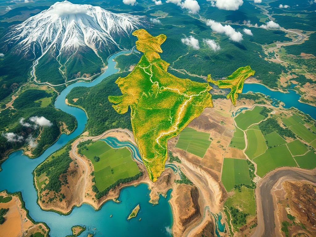
Introduction
Let me start with a confession: when I first began teaching geography, I used to dread the drainage system chapter. Not because it's difficult—but because most textbooks make it sound like reading a telephone directory. Rivers, lakes, tributaries, watersheds... it all blurs together into one monotonous list of names and numbers.
But here's what changed everything for me: I realized that India's drainage system isn't just about memorizing names for your UPSC or SSC CGL exam. It's the skeleton of our entire geography. These rivers have shaped civilizations, determined where our cities are built, influenced our climate, and literally carved out the landscape you see from your window.
I still remember sitting with a group of students in 2015, just before the SSC CGL mains, and one girl asked, "Sir, why do we even need to know about drainage patterns?" And honestly? That question changed how I teach this topic. Because once I showed them that the Ganga-Brahmaputra system supports over 400 million people, and that understanding river behavior helps predict floods and droughts, it suddenly became alive.
In this post, I'm going to walk you through India's rivers, lakes, and drainage the way I explain it to my students—not as isolated facts, but as an interconnected system that makes sense. And yes, I've got some tricks up my sleeve to make this stick in your memory.
Understanding Drainage Systems: The Basics
What Is a Drainage System, Really?
Imagine rain falling on your roof. Where does the water go? It flows downward, following the slope, collecting with other water, and eventually reaches the gutter. That's exactly what happens across a continent, except on a much grander scale.
A drainage system is simply the network of rivers, streams, and tributaries that collect water from the land and transport it to the ocean. The direction and pattern of this flow is determined by the topography—the highs and lows of the land.
Now, India has an incredibly complex drainage system because we have major mountain ranges (the Himalayas), vast plains (the Indo-Gangetic Plain), and the Deccan Plateau—all at different elevations. This creates multiple drainage basins.
The Two Major Drainage Systems in India
Here's something I tell every batch: India's drainage divides into two main systems based on where water flows—and this division follows the natural topography.
1. The Himalayan or Exogenous Rivers: These originate in the Himalayas and flow through the plains. They're called "exogenous" because they're fed by external sources (snow and rain from mountains) even as they flow through dry regions. The Ganga, Brahmaputra, and Indus are your major players here.
2. The Peninsular or Endogenous Rivers: These originate and flow entirely within the peninsula. They're shorter, have less perennial flow, and follow the slopes of the plateau. Think Godavari, Krishna, Kaveri. They're "endogenous" because they depend on internal rainfall, which means they can dry up during summer.
Let me give you a memory trick I use: "HIM-EXO, PEN-ENDO" — Himalayan = Exogenous (from outside/mountains), Peninsular = Endogenous (from inside/plateau).
The Himalayan River Systems: The Lifeblood of North India
The Ganga: More Than Just a River
If I had to pick one river that defines India, it's the Ganga. Not just because of its religious significance, but because it's absolutely crucial to understanding Indian geography.
The Ganga originates at Gangotri in the Himalayas (about 4,000 meters elevation) and flows eastward for about 2,520 kilometers before merging with the Brahmaputra and entering the Bay of Bengal. On its journey, it collects water from dozens of tributaries, creating a massive basin that supports around 400 million people—roughly one-third of India's population.
Now here's where it gets interesting: the Ganga basin is divided into several segments. The upper Ganga flows rapidly through the mountains—this is your youthful river stage. Then it enters the plains (around Kanpur), where it slows down and starts depositing sediment, creating the fertile Indo-Gangetic Plain. By the time it reaches Bengal, it's a mature river with a massive delta called the Sundarbans.
Major tributaries on the right bank: Yamuna, Chambal, Betwa, Ken Major tributaries on the left bank: Kosi, Gandak, Ghaghra, Mahananda I always tell students: memorize the pattern, not just the names. Right-bank tributaries come from the southern plateaus, left-bank tributaries come from the Himalayas.
The Brahmaputra: The Wanderer
The Brahmaputra is India's second-longest river and arguably its most unpredictable. It originates in Tibet (where it's called Tsangpo), enters India through Assam, and eventually joins the Ganga to form the Sundarbans Delta.
What makes the Brahmaputra unique is its behavior. It's an antecedent river—meaning it predates the mountains and has cut through them rather than flowing around them. This is why it has such steep gradients and such powerful discharge, especially during monsoons.
The Brahmaputra has a seasonal variation pattern that's quite extreme. During monsoons (June-September), it receives heavy rainfall in Assam and can cause severe flooding. In winter, it becomes much calmer.
The Indus: Shared With Pakistan
The Indus is India's westernmost major river and one of the world's longest. Though it originates in Tibet and flows through India (about 1,114 km) before entering Pakistan, its basin is crucial for understanding India's northwestern geography.
The five rivers of Punjab (Sutlej, Beas, Ravi, Chenab, Jhelum) are all tributaries of the Indus. This entire system was historically very important—the Indus Valley Civilization flourished along this river around 2500 BCE.
Peninsular River Systems: The Eternal Southerners
Now, the peninsular rivers are a different beast altogether. They're shorter, faster, and more seasonal. But they're absolutely critical for understanding South India's geography and economy.
The Godavari: The Dakshan Ganga
The Godavari is the longest peninsular river (about 1,465 km) and originates from the Western Ghats in Maharashtra. It flows eastward across the Deccan Plateau and enters the Bay of Bengal in Andhra Pradesh.
Here's a useful way to remember its course: it flows from the west-facing slopes of the Ghats, travels through the plateau from west to east, and exits through the eastern coast. This means it has a pretty long journey, collecting water from multiple tributaries like the Wardha, Pranhita, and Indravati.
The Krishna and Kaveri: The Southern Pair
The Krishna originates from the Western Ghats in Karnataka and flows southeastward for about 1,300 km. It's the second-longest peninsular river and supports agriculture across Maharashtra, Karnataka, Andhra Pradesh, and Telangana.
The Kaveri is shorter (about 765 km) but incredibly important for South Indian agriculture, especially for Tamil Nadu and Karnataka. It originates in the Western Ghats and flows southeast into the Bay of Bengal.
Here's a mnemonic I created for my students to remember peninsular rivers: "GCY goes East" — Godavari, Cauvery (Kaveri), and Krishna (actually Krishna goes southeast, but the pattern helps). All three flow generally eastward toward the Bay of Bengal.
The Narmada and Tapti: The Western Outliers
These two rivers are unique because they flow westward into the Arabian Sea, which makes them different from most other peninsular rivers. The Narmada originates in the Vindhyas and flows westward for about 1,312 km, while the Tapti flows westward for about 724 km. Both are important for hydroelectric power generation and irrigation.
| River | Origin | Length (km) | Direction | Outlet |
|---|---|---|---|---|
| Ganga | Gangotri (Himalayas) | 2,520 | East | Bay of Bengal |
| Brahmaputra | Tsangpo (Tibet) | 2,900 | East | Bay of Bengal |
| Godavari | Western Ghats (Maharashtra) | 1,465 | East | Bay of Bengal |
| Krishna | Western Ghats (Karnataka) | 1,300 | Southeast | Bay of Bengal |
| Kaveri | Western Ghats (Karnataka) | 765 | Southeast | Bay of Bengal |
| Narmada | Vindhyas (Madhya Pradesh) | 1,312 | West | Arabian Sea |
| Tapti | Vindhyas (Maharashtra) | 724 | West | Arabian Sea |
Lakes and Wetlands: The Often-Forgotten Treasure
Now here's where most students make a critical mistake: they focus so heavily on rivers that they completely neglect lakes. But lakes are equally important—both for exams and for actual geography.
India has three main types of lakes: mountainous lakes (created by glaciation or erosion), freshwater lakes in plains and plateaus, and coastal lakes (lagoons and backwaters).
Let me give you the most important ones to remember:
Dal Lake (Jammu & Kashmir): This is the most famous lake in India, probably because of its tourist appeal. It's a Himalayan freshwater lake and an important example of wetland ecosystem.
Wular Lake (Jammu & Kashmir): India's largest freshwater lake, also in Kashmir. It's a floodplain lake—meaning it expands and contracts with seasonal water flow.
Loktak Lake (Manipur): Famous for its floating islands (called "phumdis"), this lake is ecologically unique and supports the endangered Sangai deer.
Chilika Lake (Odisha): India's largest coastal lagoon and a crucial wetland for migratory birds. During winter, thousands of Siberian cranes visit this lake.
Sambhar Lake (Rajasthan): India's largest salt lake, important for salt production and also supports migratory flamingos.
Pulicat Lake (Tamil Nadu-Andhra Pradesh): Another important coastal lagoon, supporting fisheries and bird populations.
One of my students once asked, "Sir, do we really need to know all the lakes?" And my answer was: "No, but you need to understand the patterns." Notice how most major freshwater lakes are in the mountains or coastal areas? That's because these areas receive high rainfall or have glacial meltwater. Inland lakes, like Sambhar, are mostly salt lakes because water evaporates faster than it's replenished, leaving behind minerals.
Drainage Patterns and Their Geography Significance
Now, here's something that really impressed my exam-oriented students: understanding drainage patterns helps you predict climate, soil type, and even population distribution.
There are several drainage patterns you'll encounter:
Dendritic Pattern: This looks like a tree or human circulatory system. Rivers branch out in multiple directions because the terrain slopes uniformly. Most of North India shows this pattern.
Trellis Pattern: Rivers flow parallel to each other because they're following mountain ranges and valleys. The Himalayan foothills show this pattern beautifully.
Radial Pattern: Rivers flow outward from a central elevated point, like spokes on a wheel. You see this around volcanic cones or domes. The Western Ghats show some radial characteristics.
Understanding these patterns tells you a lot. A dendritic pattern means stable, gradually sloping land—perfect for agriculture. A trellis pattern means mountainous terrain with valleys. A radial pattern indicates local high points.
I always tell students: "Geography is about connections. When you understand why rivers flow the way they do, everything else falls into place." And that's absolutely true for drainage systems.
Final Thoughts for Your Exam Preparation
Look, I've taught this topic to thousands of students, and here's what I've learned: the students who do best on drainage systems aren't the ones who memorize every tributary. They're the ones who understand the logic.
When you prepare for your SSC CGL or UPSC, spend less time on rote memorization and more time on asking yourself questions like: "Why does this river flow in this direction? What does this tell me about the terrain? How would this affect agriculture or settlement?"
Create a simple map of India and mark all the major rivers. Don't just mark the lines—mark the direction of flow, the tributaries, and the outlets. This visual understanding will stick with you far better than any list.
And when you're revising before the exam, use that mnemonic I shared: "HIM-EXO, PEN-ENDO" for Himalayan vs. Peninsular rivers. For peninsular rivers: "GCY goes East" (Godavari, Kaveri, Krishna). These simple tricks can save you precious minutes during an exam when you're trying to recall which river flows where.
One last thing: geography isn't just about passing exams. Understanding India's drainage system means understanding how 1.4 billion people survive and thrive in this country. That's the real magic of this subject.
A) Yamuna B) Kosi C) Chambal D) Godavari
Answer: D) Godavari — It's an independent peninsular river that flows directly into the Bay of Bengal, not the Ganga.
A) Sorrow of the North B) Sorrow of Assam C) Sorrow of India D) Sorrow of the East
Answer: B) Sorrow of Assam — Due to its unpredictable nature and devastating floods, it earned this poignant nickname.
A) Krishna B) Godavari C) Narmada D) Kaveri
Answer: C) Narmada — Along with the Tapti, the Narmada is unique among major peninsular rivers in flowing westward.
A) Dal Lake B) Wular Lake C) Loktak Lake D) Chilika Lake
Answer: B) Wular Lake — Located in Jammu & Kashmir, it's India's largest freshwater lake by surface area.
A) Dendritic B) Trellis C) Radial D) Rectangular
Answer: C) Radial — This pattern resembles spokes on a wheel and is commonly seen around volcanic cones or elevated domes like the Western Ghats.
Published by Dattatray Dagale • 22 October 2026









0 Comments