Introduction
Listen, when I first started teaching geography to my batch of SSC CGL aspirants about a decade ago, I noticed something fascinating: students could memorize the capitals of every state but would completely blank out when asked about the Pir Panjal Pass or the difference between the Western and Eastern Ghats. It's like knowing the names of all 11 cricketers but not understanding the field positions, you know?
But here's what I've learned: mountain ranges and passes aren't just random geography facts to cram. They're the skeleton of India — they shape our climate, our history, our borders, and literally the way civilizations developed here. Trade routes historically followed these passes. Wars were won and lost at these mountain gates. And honestly? Once you understand the why behind these formations, remembering them becomes so much easier.
So today, I want to walk you through India's mountain ranges and passes the way I explain them to my students — not as isolated facts, but as a connected, living, breathing geography that makes perfect sense.
The Great Himalayan System: India's Crown Jewel
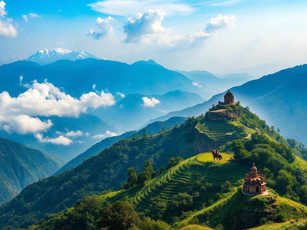
Let's start with the big kahuna — the Himalayas. Now, I won't bore you with the entire geological history, but here's what you absolutely need to know: the Himalayas are the youngest mountain range on Earth, and they're still growing. Every year, they rise by about 2 centimeters. Imagine that — the mountain you visit today will be slightly taller next century!
The Himalayas can be divided into three parallel ranges running east to west. Let me give you a memory trick I tell every single one of my students:
"GWH" — Great, White, Himadri.
Here's how it works:
The Greater Himalayas (or Himadri) form the northernmost range. These are the real mountains — peaks like Kangchenjunga, Makalu, and Mount Kanchenjunga. The height here ranges from 6,000 to 8,848 meters. This is where the snow never melts.
The Middle Himalayas (or Himachal) lie south of the Greater range. They're lower (3,000 to 5,000 meters) but incredibly important because they have beautiful valleys and are densely populated. Shimla, Darjeeling, Mussoorie — all these hill stations sit in the Middle Himalayas. Think of them as the "Goldilocks zone" — not too high, not too low.
The Outer Himalayas (or Shivaliks) are the foothills you'll actually see from the plains. These are the youngest and most fragile geologically. They're covered in forests and are only 1,000 to 1,500 meters high. The Duars of Assam and the Terai of Uttar Pradesh fall here.
Important Himalayan Passes — Your Must-Know List
Now, a pass is basically a route through the mountains where the elevation is low enough for people, armies, and traders to cross. Think of it as nature's doorway through an otherwise impenetrable wall.
Khyber Pass: This is the most historically significant pass in all of India. It connects present-day Pakistan to Afghanistan. So many invaders used this route — the Aryans, the Mughals, everyone. When you see historical movies about invasions of India, half the time they're talking about the Khyber Pass. Height: 1,067 meters. Remember it as the "Gateway of Invasions."
Pir Panjal Pass: Located in Kashmir, this one connects the Kashmir Valley to the outer regions. It's been crucial for trade and military movements. Height: 1,582 meters. I tell students: "Pir Panjal = Path In the Region, Past Jammu And the Lakes."
Banihal Pass: Another Kashmir pass, connects Srinagar to Jammu. In modern times, there's actually a tunnel here that the Indian Railways built. Pretty cool when you realize how ancient geography meets modern engineering!
Rohtang Pass: This one's at 3,978 meters in Himachal Pradesh. It's the entry point to the Kullu-Manali region. In winter, it gets so snowed in that the entire Lahaul-Spiti region gets cut off from the rest of India. That's how powerful these mountain passes are!
Niti and Mana Passes: Both in Uttarakhand, these were historically important for trade with Tibet. The Silk Road, believe it or not, had connections through these passes.
Chang La and Ladakh Pass: These connect the Ladakh region to other areas. Chang La is at 5,059 meters — one of the highest motorable passes in the world. I had a student who trekked it and came back with stories that genuinely helped him remember these passes better!
The Deccan Plateaus and the Western and Eastern Ghats
Okay, so south of the Indo-Gangetic Plain, we have this massive triangular plateau surrounded by two mountain ranges. I call it the "Deccan Diamond" because it literally looks like a diamond shape on the map.
The Western Ghats: The Rainmaker Mountains
The Western Ghats run along the western edge of the Deccan Plateau, from Gujarat all the way down to Kerala. They're around 1,600 kilometers long and average about 1,000 meters in height. Now here's the interesting part: they're incredibly important for India's climate.
When the Southwest Monsoon winds hit these mountains, they're forced to rise, cool down, and drop their moisture. That's why the Western Ghats receive tons of rainfall — places like the Konkan coast and Kerala get absolutely drenched. In fact, some parts get over 6,000 mm of rainfall annually!
The Western Ghats are also a biodiversity hotspot. UNESCO recognizes them as one of the world's eight hottest biodiversity hotspots. Think about that — they're not just geography, they're literally repositories of life on Earth.
Important peaks: Anai Mudi (the highest peak in South India, 2,695 meters), Doddabetta, and Ooty all lie in the Western Ghats.
The Eastern Ghats: The Gentler Cousin
The Eastern Ghats run along the eastern edge, from Odisha down to Tamil Nadu. But here's the catch: they're much lower (averaging 600 meters), more fragmented, and far less continuous than the Western Ghats. They're like a broken fence compared to the Western Ghats' solid wall.
Because of this, the Eastern Ghats don't block monsoons as effectively. That's why East India gets less rainfall and has a different vegetation pattern. Interesting how geography creates these domino effects, right?
Important peaks: Mahendragiri in Odisha is the highest at 1,501 meters.
Let me give you another memory trick that's worked brilliantly with my students:
"WG-HIGH, EG-LOW" — Western Ghats are HIGH and CONTINUOUS, Eastern Ghats are LOW and BROKEN. This automatically tells you their climate impact too!
| Mountain Range | Location | Average Height | Key Features |
|---|---|---|---|
| Himalayas | North India | 6,000-8,848m | Youngest range, still growing, source of major rivers |
| Western Ghats | Western Coast | 1,000-2,695m | Continuous, blocks monsoons, high rainfall, biodiversity hotspot |
| Eastern Ghats | Eastern Coast | 600-1,501m | Discontinuous, lower rainfall, fragmented structure |
| Aravalli Range | Northwest India | 500-900m | Oldest mountain range, runs Rajasthan to Delhi |
| Vindhya Range | Central India | 600-900m | Divides North and South India |
Other Important Mountain Ranges and Passes
The Aravalli Range: The Oldest of Them All
The Aravallis are the oldest mountain range in India — older than the Himalayas, older than the Deccan! They run from Gujarat through Rajasthan to Delhi and even into Haryana. But because they're so ancient, they've been heavily eroded. They average only 500-900 meters. I like to think of them as mountains that have settled into their old age!
Despite being low, they're super important. They divide Rajasthan into two regions and influence local climate patterns. Also, they were crucial for mining — precious stones and metals have been extracted from the Aravallis for centuries.
Guru Shikhar is the highest peak (1,722 meters) and lies in Mount Abu, Rajasthan. Fun fact: Mount Abu is the only hill station in Rajasthan!
The Vindhya and Satpura Ranges
These two ranges run parallel in Central India. The Vindhyas run roughly east-west and form an important boundary — historically, they separated North India from South India. Kingdoms didn't easily cross the Vindhyas!
The Satpura Range, running parallel to the south, is less known but equally important. Together, these ranges create what's called the Narmada-Tapti valley between them.
Key pass: The Asirgarh Fort sits on the Satpura Range and was historically crucial for controlling passage through Central India.
The Nilgiri Hills: Where Ranges Meet
This is where the Western Ghats and Eastern Ghats actually meet in Tamil Nadu. It's a unique geography. The word "Nilgiri" literally means "blue mountains" because of the bluish haze you see when viewing them. Ooty, one of India's most famous hill stations, sits right here.
Doddabetta (2,633 meters) is the highest peak in the Nilgiris.
Why These Mountains and Passes Still Matter Today
You might wonder: okay, these are cool facts, but why does it matter that I know about them? Here's where it gets real.
First, geopolitics. Every border dispute India has — whether it's the Kashmir issue or the Northeast border disputes with China — revolves around these mountains and passes. When you understand the geography, you understand the news better.
Second, climate and agriculture. The monsoon patterns that decide whether we get good rains or drought are entirely shaped by these ranges. The type of crops grown in different regions, the water availability, everything traces back to mountain geography.
Third, for exams specifically, the questions on these topics appear in very specific formats. You'll get questions like "Which pass connects..." or "Which mountain range causes..." Understanding the connections helps you answer them correctly, even if the exact question has never been asked before.
I had this student, Priya, who struggled with geography initially. But once I made her understand that these weren't just names to memorize but actual places with actual consequences on real lives — she not only scored well but also genuinely enjoyed the subject. That's the shift I want for you too.
Final thought: When you're studying these ranges and passes, don't just memorize. Open a physical map, trace them with your finger, look at the heights, and think about what happens when monsoons hit them or armies try to cross them. That's the kind of active learning that makes geography stick. And honestly? That's the only way you'll truly master this topic for your exams.
Now, let's test what you've learned:
A) Eastern Ghats B) Western Ghats C) Nilgiris D) Satpura
Answer: B) Western Ghats (Anai Mudi at 2,695 meters)
A) Himalayas B) Western Ghats C) Aravallis D) Vindhyas
Answer: C) Aravallis (they're pre-Cambrian in origin, over 1 billion years old)
A) India and Nepal B) Kashmir and Ladakh C) India and Afghanistan (via Pakistan) D) Himachal and Uttarakhand
Answer: C) India and Afghanistan (via Pakistan) — historically the most important invasion route
A) They're taller B) They're continuous and directly face the Southwest Monsoon C) They have more vegetation D) They're closer to the equator
Answer: B) They're continuous and directly face the Southwest Monsoon, causing orographic rainfall
A) Pir Panjal Pass B) Rohtang Pass C) Banihal Pass D) Chang La
Answer: B) Rohtang Pass (at 3,978 meters, often gets blocked in winter)
Published by Dattatray Dagale • 03 September 2026
.jpg)
.png)



.png)




.png)

0 Comments