Introduction
Let me tell you something. Ten years of teaching SSC CGL aspirants has shown me one thing very clearly: students fear Indian geography like it's a Bollywood villain. But here's the plot twist — it's actually the easiest section to crack once you understand the *why* behind everything.
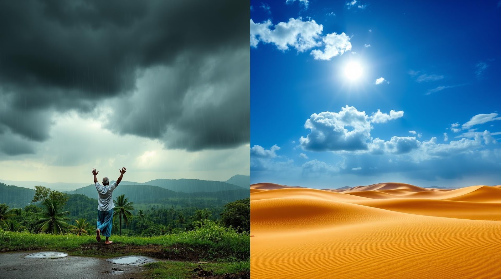
Today, we're talking about monsoons and climate. And I'm not going to bore you with definitions. Instead, I want you to feel the southwest monsoon the way a farmer in Maharashtra feels it — like it's bringing life itself.
You see, India's climate isn't random. It follows a pattern, almost like a Raag in Indian classical music. Once you understand the notes, everything falls into place. That's what we're doing today.
What Makes India's Climate Special?
Here's a question I ask every batch: Why does it rain more in Mumbai than in Delhi? Why is Rajasthan a desert while Kerala is a rainforest? The answer lies in one word — latitude, longitude, and geographical position. Okay, that's three words, but who's counting?
India lies between 8°N and 35°N latitude, which places most of the country in the tropical and subtropical regions. This is crucial. This means India gets:
Intense solar radiation — The sun is almost directly overhead for a good part of the year. This heats the landmass unevenly, creating pressure differences that drive wind systems.
The Himalayas as a barrier — Those mountains aren't just there for trekking. They block cold winds from Central Asia, keeping northern India relatively warm. They also force moisture-laden winds to rise and release their water.
Surrounded by oceans on three sides — The Arabian Sea, Bay of Bengal, and Indian Ocean moderate temperatures and bring moisture.
Now, here's where it gets interesting. India's climate is dominated by a phenomenon that affects billions of lives every year. That phenomenon is the monsoon. And unlike what your textbook might suggest, it's not just about rain. It's about wind direction, pressure systems, and the entire circulation of air over the Indian subcontinent.
The Role of Pressure Systems and Wind Patterns
During winter, high pressure develops over Central Asia and Siberia. This creates cold, dry winds that blow from northeast to southwest across India. We call this the Northeast Monsoon or Winter Monsoon. It brings dry, cold weather to most of India, except for parts of Tamil Nadu and southern Andhra Pradesh, which receive some rainfall from this system.
But summer? That's when the real drama happens. The landmass of Asia heats up rapidly (more than the oceans), creating a low-pressure zone. The sun moves northward, the Intertropical Convergence Zone (ITCZ) shifts, and suddenly, winds reverse. Moisture-laden winds from the Indian Ocean and Arabian Sea start moving toward India.
This is the Southwest Monsoon, and it's the lifeline of Indian agriculture. Between June and September, these winds bring about 75-80% of India's annual rainfall. No monsoon? No harvest. No harvest? Economic crisis. This is why ancient Indians worshipped the monsoon gods.
Understanding the Southwest Monsoon: India's Lifeline
Let me give you a trick I tell all my students. To remember the path of the Southwest Monsoon, think: **"TWO BRANCHES, LIKE A TREE"**
The Southwest Monsoon arrives in two branches — literally. It's like the monsoon winds are following a map designed by nature itself.
The Arabian Sea Branch
This branch brings moisture from the Arabian Sea and hits the Western Ghats first. Remember, the Western Ghats run north to south along India's western coast. When these moisture-laden winds hit this mountain range, they're forced to rise. Rising air cools, water vapor condenses, and boom — heavy rainfall.
This is why places like Mawsynram in Meghalaya (which receives about 11,000 mm of rain annually) are so wet. This is also why Mumbai gets heavy showers during July-August, even though it's on the coast. The Western Ghats force the monsoon winds upward.
Once the winds cross the Western Ghats, they lose their moisture and become dry. This creates a rain shadow on the leeward side — which is why places like Pune, just 100 km east of Mumbai, receive much less rain. This single fact should help you answer at least 5 questions in your exam.
The Bay of Bengal Branch
This branch comes from the Bay of Bengal and moves toward the Indian subcontinent. It affects eastern and northern India. The moisture content here is also high, but since there's no major mountain range immediately on the coast in eastern India (the Himalayas are much further north), the pattern is different.
These winds follow the Indo-Gangetic Plain, reach the Himalayas, and release their moisture there. This is why Assam, Meghalaya, and the sub-Himalayan regions receive tremendous rainfall. The Himalayas act as a giant barrier, forcing these winds upward.
However, as these winds move inland and lose altitude, they lose moisture. This is why central India receives less rainfall than the coast, even though it's monsoon season everywhere.
India's Climate Zones: A Patchwork Pattern
Here's something that confuses many students: India has almost every type of climate zone. Deserts, rainforests, tropical regions, temperate regions — all within the same country. How is this possible?
The answer is the uneven distribution of rainfall caused by the monsoon and the varied topography of India.
The Classification of Climate Zones
Based on the Köppen classification, India experiences:
Tropical Wet (Tropical Rainforest): Areas receiving more than 2,250 mm of rainfall annually. Examples: Kerala, coastal Karnataka, Assam. These areas remain warm and wet throughout the year.
Tropical Monsoon: Areas receiving 1,500-2,250 mm of rainfall, mostly concentrated in monsoon months. Examples: Tamil Nadu, parts of Andhra Pradesh.
Tropical Dry/Semi-Arid: Areas receiving 750-1,500 mm of rainfall. Examples: Central India, including parts of Maharashtra and Madhya Pradesh. These regions have distinct wet and dry seasons.
Desert and Semi-Desert: Areas receiving less than 750 mm of rainfall. Examples: Rajasthan, parts of Gujarat. Here, evaporation exceeds rainfall, creating arid conditions.
Subtropical: Northern plains and sub-Himalayan regions. Examples: Delhi, Uttar Pradesh. These regions have four distinct seasons.
Now, here's a memory trick for the rainfall zones: **"TOAST MY BREAD"**
T = Tropical Wet (2,250+) | O = Over 1,500 mm (Monsoon) | A = Around 750-1,500 (Arid becoming semi-arid) | S = Semi-Desert (< 750) | T = Temperature-based (Subtropical)
Okay, that's a stretch, but memory tricks don't have to be perfect. They just have to stick!
| Climate Zone | Annual Rainfall | Key Regions | Characteristics |
|---|---|---|---|
| Tropical Wet | > 2,250 mm | Kerala, W. Ghats | High rainfall, humid, evergreen forests |
| Tropical Monsoon | 1,500-2,250 mm | Tamil Nadu, coastal regions | Seasonal rainfall, deciduous forests |
| Tropical Dry/Semi-Arid | 750-1,500 mm | Central India, parts of Maharashtra | Distinct wet and dry seasons |
| Desert/Semi-Desert | < 750 mm | Rajasthan, parts of Gujarat | Very low rainfall, hot, sparse vegetation |
| Subtropical | Variable (500-2,000 mm) | North Plains, Sub-Himalayas | Four distinct seasons, cool winters |
The Northeast Monsoon and Other Wind Systems
While the Southwest Monsoon gets all the attention (and rightly so, because it's crucial for agriculture), we can't ignore the Northeast Monsoon. Between October and December, as the sun's direct rays move southward, pressure patterns reverse again.
Cold, dry winds from the northeast bring winter to most of India. However — and this is important — some regions actually receive rainfall during this period. Tamil Nadu and parts of southern Andhra Pradesh receive significant rainfall from the Northeast Monsoon. Why? Because these winds pick up moisture while crossing the Bay of Bengal, and when they hit the eastern coast, they release it.
Beyond these primary monsoons, there are other wind systems worth knowing:
Loo: These are hot, dry winds that blow across the Indo-Gangetic Plain during May and June. They can reach temperatures of 50°C and are notorious for causing heat-related illnesses. Loo is a local wind specific to northern India.
Jet Streams: Upper atmosphere winds that influence monsoon onset and withdrawal. The subtropical jet stream shifts northward with the movement of the sun, affecting when the monsoon arrives.
Understanding these wind systems is critical. In your exam, you might get a question asking why a particular region experiences rainfall during the Northeast Monsoon or why the Southwest Monsoon arrives in June rather than May. The answer always comes back to pressure systems and wind directions.
Quick Exam Takeaways
Before we wrap up, let me give you the non-negotiable facts that will help you answer at least 80% of climate-related questions in your SSC CGL or UPSC exam:
1. The Southwest Monsoon is THE monsoon. It brings 75-80% of India's annual rainfall between June and September. Most of your questions will revolve around this.
2. The Western Ghats create a rain shadow. West of the Ghats: Heavy rain. East of the Ghats: Dry. This single concept can answer 5+ questions.
3. Orographic rainfall is your friend. Whenever winds hit a mountain, they rise, cool, and release moisture. This happens with the Western Ghats and the Himalayas.
4. India's northeast is the wettest region. Assam and Meghalaya receive the heaviest rainfall due to the Bay of Bengal branch of the monsoon hitting the Himalayas directly.
5. Monsoon onset and withdrawal are predictable. The Southwest Monsoon arrives in June in Kerala (because of its latitude) and withdraws between September and October.
These five facts are your foundation. Everything else builds on them.
Geography isn't hard. It's just detailed. Once you understand that every climate zone, every rainfall pattern, and every wind direction exists for a reason, you start seeing the beauty in it. And when you find something beautiful, it sticks in your memory. That's the real trick to cracking this section.
Published by Dattatray Dagale • 28 May 2026
.jpg)
.png)


.png)

.png)


0 Comments