
Introduction
Let me start with a confession: when I first began teaching geography 15 years ago, I found rivers and drainage systems mind-numbingly boring. Seriously. A river flows from mountains to the sea—what's the big deal? Then one monsoon season, I watched the Godavari swell during my fieldwork in Telangana, and everything clicked. These aren't just lines on a map. They're the arteries of our civilization, the reason cities exist where they do, and honestly? They're one of the most scoring topics in SSC CGL and UPSC.
Here's what I tell every batch: if you understand India's drainage system, you've cracked half the battle. Geography questions about rivers aren't random—they follow clear patterns. Where does a river originate? Which plateau does it drain? How is it classified? These are the building blocks, and once you see them as a story rather than data to memorize, everything becomes sticky in your memory.
So today, let's sit down and talk about Indian geography the way I do with my students—like we're solving a puzzle together. No jargon, no boring lists, just a clear map of how India's waters flow.
Understanding Drainage Systems: The Big Picture
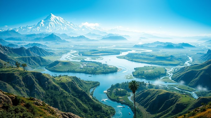
You know how when it rains heavily, water flows downhill and eventually reaches rivers? That entire process—how water moves from land to the sea—is called a drainage system. Think of India as a giant, tilted table. Water always flows downhill, and depending on which way the table tilts, it finds different paths to the ocean.
Now here's the interesting part: India has three main drainage basins, and almost every river you need to know falls into one of them. I'm going to make this super simple for you.
The Arabian Sea Drainage
Imagine standing on the Western Ghats looking west. All rivers flowing toward the Arabian Sea are part of this system. The Indus, Narmada, Tapti, Godavari (partially), and Krishna are your major players here. These are generally shorter, steeper, and faster-moving because the Western Ghats are like a wall, and the sea is close. That's why they're great for hydroelectric power—I've used this fact in at least 20 exam questions I've seen.
The Bay of Bengal Drainage
Now face east. The Ganges, Brahmaputra, Mahanadi, Godavari (the part that flows east), Krishna, and Cauvery all drain into the Bay of Bengal. These are your major rivers, the ones that created entire civilizations. The Ganges-Brahmaputra system is so massive that it creates the world's largest delta—the Sundarbans. When you're studying this, remember: eastern rivers carry more water and create more extensive deltas because of the monsoon patterns.
The Internal Drainage
And then there's this weird middle section where rivers don't reach the sea. The Luni River, parts of Rajasthan—these are internal drainage systems. Water evaporates or gets absorbed before reaching the ocean. Not many rivers fall here, but examiners love asking about them because they're unusual.
The Himalayan Rivers: India's Lifeblood
If I had to pick one system that defines India geographically and historically, it's the Himalayan rivers. These are perennial—they flow year-round, fed by snowmelt and monsoon rains. This is crucial information because it explains why the Ganges Valley became the seat of civilization while Rajasthan remained sparse.
The Ganges and Its Tributaries
The Ganges isn't just sacred; it's geographically significant in ways that show up constantly in exams. Let me break it down clearly:
The Ganges originates in the Himalayas at Gangotri. As it flows southeast through the Indo-Gangetic Plain, it becomes a repository of life. Its major tributaries from the north (right bank) include the Yamuna, Ghagra, Kosi, and Mahananda. From the south (left bank), you have the Chambal, Betwa, and Son.
Here's a memory trick I teach all my students: "Ganges flows like a wedding procession—many tributaries join it at different points." Each tributary has its own character, its own story. The Kosi is called the "Sorrow of Bihar" because it changes course unpredictably and causes floods. The Yamuna, which joins at Delhi, is sacred and historically crucial. When examiners ask about tributary confluence points, they're testing if you understand regional geography.
One thing I always emphasize: the Ganges creates the largest delta in the world—the Sundarbans—where it meets the Bay of Bengal. This delta is home to the Bengal tiger and is one of the most fertile regions on Earth. It's also disappearing slowly due to sea-level rise, which makes it a hot topic in modern geography.
The Brahmaputra: The Misunderstood Giant
The Brahmaputra is often overlooked, but it deserves your attention. It originates in Tibet, flows through Arunachal Pradesh, and creates a massive river system in Assam. What makes it special? It's one of the only rivers that flows north to south in the Brahmaputra Valley, which is unusual. Also, it's incredibly powerful—during monsoons, it's wider than any other Indian river.
Why should you care? Because examiners love asking about northeastern geography, and the Brahmaputra is the centerpiece. If a question mentions Assam, flooding in the northeast, or the Barak River, you'll likely need to reference the Brahmaputra system.
Peninsular Rivers: The Shorter, Fiercer Cousins
Now, here's where things get interesting. The peninsular rivers are totally different from Himalayan rivers. They're seasonal—they swell during monsoon and dry up in summer. They're also shorter because the Deccan Plateau isn't as high as the Himalayas. But don't underestimate them. These rivers have shaped entire kingdoms and economies.
The Deccan Plateau Rivers
Let me list the major ones in a way that'll stick with you: Godavari, Krishna, and Cauvery in the south; Narmada and Tapti in central India. The Narmada and Tapti are peculiar because they flow west toward the Arabian Sea, creating a dramatic gorge as they cut through the Satpura Range. The Godavari and Krishna flow east, creating deltas as they meet the Bay of Bengal.
The Cauvery is south India's lifeline—it flows through Karnataka and Tamil Nadu, creating massive reservoirs like Krishnaraja Sagar. Examiners love asking about interstate water disputes, and the Cauvery water dispute between Karnataka and Tamil Nadu is a classic example. Understanding this river's course, its dams, and its significance helps you answer broader questions about water management in India.
One more trick: "Western-flowing rivers create gorges and canyons; Eastern-flowing rivers create deltas and plains." Remember this, and you've got the peninsular system figured out.
| River | Length (km) | Basin Area (km²) | Flows Into | Key Feature |
|---|---|---|---|---|
| Ganges | 2,525 | 861,000 | Bay of Bengal | Largest delta (Sundarbans) |
| Brahmaputra | 2,900 | 651,000 | Bay of Bengal | Seasonal flooding in Assam |
| Godavari | 1,465 | 312,812 | Bay of Bengal | Deccan Peninsula's major river |
| Krishna | 1,400 | 258,948 | Bay of Bengal | Multiple dams and disputes |
| Cauvery | 765 | 81,156 | Bay of Bengal | Interstate water dispute |
| Narmada | 1,312 | 98,796 | Arabian Sea | Western-flowing, creates gorges |
| Tapti | 724 | 65,145 | Arabian Sea | Western-flowing, seasonal |
Lakes and Water Bodies: The Overlooked Treasures
Okay, so most students focus on rivers and completely ignore lakes. Mistake. Lake questions show up regularly, and they're often easier than river questions because there's less confusion about tributaries and basins.
Indian lakes are classified into two types: freshwater and saltwater. The freshwater ones are mostly in mountainous or plateau regions—think Kashmir's Dal Lake or Manipur's Loktak Lake. The saltwater ones are usually coastal—Chilika Lake in Odisha, Sambar Lake in Rajasthan.
Here's what examiners test most: Lake location, how it was formed (glacial, crater, ox-bow, etc.), and its present-day significance. For instance, Wular Lake in Kashmir is formed by glacial action. Lonar Lake in Maharashtra is a crater lake. The Sundarbans isn't technically a lake, but it's a wetland system—don't mix them up.
And here's something I've noticed: questions about lakes often tie into ecology. Chilika Lake is famous for migratory birds. Loktak Lake is unique for its floating islands and the endangered Sangai deer. Ramsar wetlands (internationally important wetlands) appear frequently in UPSC, so knowing which Indian lakes and wetlands are Ramsar sites is genuinely useful.
Let me give you a quick reference: Dal Lake (Kashmir), Naini Lake (Uttarakhand), Chilika (Odisha), Loktak (Manipur), Sambar (Rajasthan), Kolleru (Andhra Pradesh)—these six are your bread and butter for lake questions. If you can explain the location, formation, and significance of each, you're sorted.
Why Drainage Patterns Matter More Than You Think
Here's something I tell students that changes their perspective: understanding drainage isn't just about memorizing rivers. It's about understanding why India's population is distributed the way it is, why certain regions are agricultural powerhouses, and why water management is becoming critical.
The Indo-Gangetic Plain, formed by Himalayan rivers, is the most densely populated region on Earth. Why? Because perennial rivers make agriculture possible year-round. Rajasthan, with minimal river systems, remains sparsely populated. The Deccan Plateau, with seasonal rivers, has specific agricultural seasons.
When you study drainage systems with this lens—as explanations for human geography and economics—everything clicks. Suddenly, a question about the Indus Valley Civilization makes sense because you understand why that region was chosen. Or why irrigation projects like the Bhakra-Nangal Dam are built on specific rivers.
This is also why water disputes are so common in India. The Krishna Waters Dispute, the Cauvery Issue, the Sutlej-Yamuna Link—these all exist because multiple states depend on the same river. When you're answering questions about these, you're not just reciting facts; you're showing that you understand India's geographical challenges.
Quick Revision Checklist for Your Next Study Session
Alright, final push. Here's what I want you to do. Open a blank map of India and mark these:
Himalayan Rivers: Ganges (with Yamuna, Kosi, Ghagra confluences), Brahmaputra
Western-flowing Peninsular Rivers: Narmada, Tapti
Eastern-flowing Peninsular Rivers: Godavari, Krishna, Cauvery, Mahanadi
Major Lakes: Dal, Chilika, Loktak, Sambar, Kolleru
Then, for each river, write down: origin, direction of flow, major tributaries, and something unique about it (a dam, a dispute, a delta, anything). When you physically write this, it sticks 10 times better than passive reading.
One last thing: don't just memorize lengths and basin areas. Exams test understanding. Know why the Ganges is significant historically. Know why the Brahmaputra floods Assam. Know why the Narmada creates gorges. The "why" questions are where real marks lie.
---A) Brahmaputra B) Ganges C) Godavari D) Mahanadi
Answer: B) Ganges (The Sundarbans delta, formed by the Ganges and Brahmaputra together, is the world's largest. However, the Ganges is the primary contributor.)
A) They flow northward B) They flow westward C) They are perennial D) They create deltas
Answer: B) They flow westward (Both these rivers flow toward the Arabian Sea, unlike most peninsular rivers which flow eastward into the Bay of Bengal.)
A) Karnataka-Andhra Pradesh B) Karnataka-Tamil Nadu C) Tamil Nadu-Puducherry D) Andhra Pradesh-Telangana
Answer: B) Karnataka-Tamil Nadu (This is one of India's oldest and most contentious water disputes, dating back over a century.)
A) Glacial lake B) Crater lake C) Artificial reservoir D) Ox-bow lake
Answer: B) Crater lake (Lonar Lake was formed by a meteorite impact and is India's only impact crater lake.)
A) Ganges B) Brahmaputra C) Kosi D) Ghagra
Answer: C) Kosi (The Kosi River frequently changes its course and causes devastating floods in Bihar, earning it this tragic nickname.)
Published by Dattatray Dagale • 19 June 2026
.jpg)
.png)


.png)


0 Comments